Study by ETSU grad supports theories of Gray Fossil Site origins
JOHNSON CITY (June 2, 2021) – A “storymap” telling the story of the Gray Fossil Site using maps of fossils clarifies how the site formed and improves paleontological research.
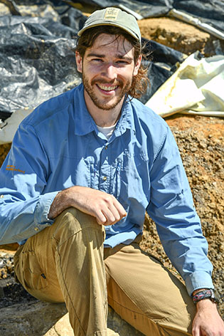
“Spatial Analyses of the Gray Fossil Site Vertebrate Remains” was created by David
Carney, a May graduate of ETSU’s master’s degree program in geosciences with a concentration
in paleontology. This study combined geographic information systems (GIS) and vertebrate
taphonomy – the study of what happens to animals after death and burial – and was
published as his master’s thesis. 
Carney won three awards for his work this spring from the annual Tennessee Geographic Information Council: Best Student Map Submission, Best Interactive Map and Viewer’s Choice.
“This created a lot of exposure for the Gray Fossil Site across the state,” said Dr. Arpita Nandi, professor and chair of the ETSU Department of Geosciences, “and was a great way for people to learn about the site and its uniqueness, especially people who have never been to the Gray Fossil Site or heard about it. It is also rare for one individual to win all three of these categories.”
Carney first studied GIS at Eastern Connecticut State University. After completing his undergraduate work, he joined an AmeriCorps program, the National Civilian Community Corps. He later worked as a naturalist with the Forestry Service in Bozeman, Montana.
While in Montana volunteering with the Museum of the Rockies, he rediscovered a longtime love of paleontology and realized how all of his past educational and field experiences help shape him for work in that field. He was glad to find ETSU, with what he said is a rare combination of graduate programs in both paleontology and geospatial analysis.
For his thesis, he wanted to analyze spatial patterns in paleontological data using GIS software. ETSU and the Gray Fossil Site was the perfect fit.
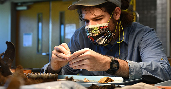
Paleontologists at the Gray Fossil Site have collected spatial information on fossils since the site’s discovery in 2000. Every fossil has been mapped using surveying equipment before being removed from the ground.
With 20 years’ worth of data, Carney had an opportunity to apply new techniques to improve interpretations at the site.
“We are looking for spatial trends,” he said. “You can use that information to get an idea of how these things were preserved. That falls in the field of taphonomy, which is a sub-field within paleontology that is basically the study of what happens to an organism after it dies, all the way up to how we find it as a fossil. Taphonomy considers many post-death processes, but I was interested in spatial taphonomy, which looks at the spatial organization of the bones.”
Carney said different things influence the way fossilized bones are organized. For instance, if animal remains were deposited in a river setting, the remains would be oriented with the direction of the water flow.
So he looked at the patterns of bone placement to begin making hypotheses about the pits and about how the Gray Fossil Site formed.
One of the most interesting things he studied is the mastodon that was discovered in 2015.
“This is the biggest animal they’ve discovered at the site so far, and one of the more complete specimens,” Carney pointed out. “This site represents a sinkhole environment where nearby animal and plant remains collect and preserve exquisitely in the black clay layers commonly found at the site. The mastodon material, however, was highly fragmented and identified in a poorly sorted geologic deposit where the fossils are mixed with different-sized rocks, such as clays, sands, and even large boulders. These types of deposits generally indicate a rapid debris movement such as a landslide.
“Curiously, the mastodon was found near the bottom of this deposit near where it meets back up with the black clays below. So when they discovered this they started to think, ‘Was this mastodon at the edge of this sinkhole, maybe getting water or something, and triggered this event?’ And ‘Was it kind of captured in this landslide that basically led to its death?’”
Carney made three-dimensional models of the deposit’s boulders and the mastodon fossil fragments in the ArcGIS software to look at trends.
Based on the models, the boulders – some of which were so large that they had to be removed using explosives – and mastodon elements were intertwined, and while some bones were nicely articulated, such as the arm bone with the shoulder, others were fragmented.
“The relationship between the boulders and the mastodon definitely highlights that these things were deposited together,” Carney said. “We can’t say for sure whether it was alive when this happened, but the skeleton was definitely swept up in a debris flow.”
Carney believes his work with the ArcGIS software could have an impact on the way paleontologists work in general.
“What I’m really hoping, because a lot of these techniques are new and no one’s really done this before, is that these techniques I’ve used will start taking off in paleontology. This could show paleontologists that GIS can help them investigate fossil sites in a detailed manner that wasn’t necessarily possible even 10 years ago. It’s easier to keep track of data, and so I think GIS is going to be a really valuable tool for paleontologists in the future. And, I hope that people who are experts in GIS will see this and realize this is another avenue for their work.”
Carney is excited to be spending this summer at the Gray Fossil Site, where he will not only participate in field excavations, but also have an opportunity to begin implementing the techniques he developed while working on his storymap thesis.
“What’s really cool about paleontology is that it’s been a science for a long time, and you’d think we would have found most of the cool stuff by now,” Carney said. “But as we’re getting new technology and people are just going to more remote places, we’re still finding amazing things.”
Visit https://bit.ly/2RrRX40 to view Carney’s storymap of the Gray Fossil Site.
